

Flying over uneven landscapes can be one of the biggest hurdles for unmanned aerial vehicles (UAVs). Terrain with sharp ascents and descents demands that a drone adjust its flight path quickly and accurately to keep a safe height above the ground. This is where drone terrain following comes in, and companies like Benewake are helping to bring reliable sensing technology to these challenging operations.
Understanding Terrain Following
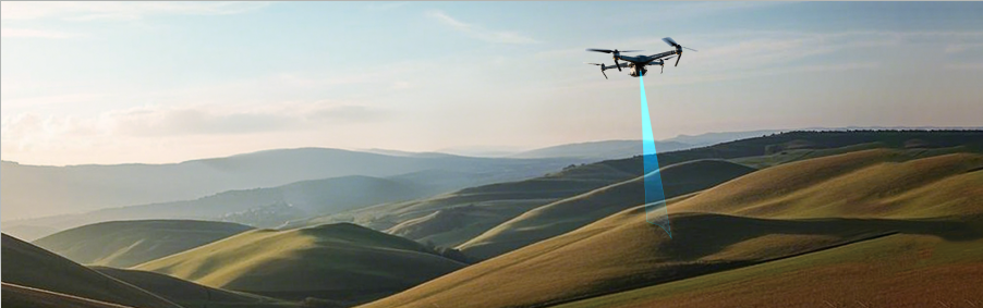
Terrain following refers to the capability of a drone to adapt its altitude in real time as the land beneath it rises or falls. Unlike traditional methods that might use barometric pressure or GPS alone, terrain-following systems typically depend on real-time distance measurements to the ground surface. With LiDAR sensors, a drone continuously emits laser pulses downward, captures the reflections, and calculates the exact distance to the terrain directly underneath. This precise measurement allows the flight controller to adjust motor power and maintain a predefined height above ground level (AGL).
This continuous adjustment is vital when approaching steep hills or descending into valleys. If a drone simply flew at a set altitude based on its takeoff point, it could crash when the terrain rises suddenly or lose data resolution when flying too high over a slope. Terrain following keeps the flight path smooth and aligned with ground contours.
The Role of Sensors in Steep Gradients
LiDAR technology plays a crucial role in this process. By providing absolute distance data at high frequencies, LiDAR enables immediate altitude corrections even when the terrain changes quickly beneath the UAV. Compared to barometric altimeters that can drift due to atmospheric conditions, LiDAR offers stable, centimeter-level accuracy in real time, which is especially useful on slopes where the height difference can vary significantly over short distances.
At Benewake, LiDAR sensors designed for drones support terrain following alongside other functions such as altitude hold and real-time obstacle detection. These sensors can integrate with flight controllers to provide dependable data that informs dynamic flight adjustments in varied landscapes.
Practical Benefits of Terrain Following
Using terrain-following technology enhances safety and data quality. In agricultural missions, for example, a drone can keep a constant height above crops even if the field slopes. For mapping and surveying, it ensures that altitude differences don’t compromise data accuracy. Precise altitude adaptation reduces the risk of accidental ground impact and improves overall mission consistency.
Conclusion
Steep gradients need not be a barrier for drone operations. With the right sensing technologies, drone terrain following enables UAVs to respond to changes in elevation fluidly and safely. Benewake’s LiDAR systems provide real-time distance information that supports terrain adaptation and enhances flight control, ensuring better performance across varied landscapes. Ready to improve your drone’s ability to navigate uneven terrain? Explore Benewake’s LiDAR solutions and take your UAV missions further with confidence.